Cambridge is a city of around 140,000 in southwestern Ontario. The city was formed in 1973 by the amalgamation of the city of Galt, the towns of Preston and Hespeler, and a few surrounding villages. The three main founding communities grew to prominence in the 1800s as mill and manufacturing towns, centred along the Grand River (Galt), and the Speed River (Preston and Hespeler.)
I was born in the city of Galt and grew up in what later became Cambridge. Although I moved away over a decade ago, I visit the city often. These photos, all of the Galt area of Cambridge, were taken between 2009 and 2019.
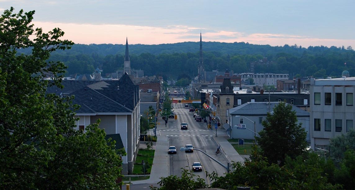
On the banks of the Grand. The downtown core of Galt is nestled in the valley created by the Grand River. The residential west side sloping up from the river is hidden behind a screen of mature trees. This view, from Centennial Park, on the east side, looks down Main Street toward Queen’s Square.
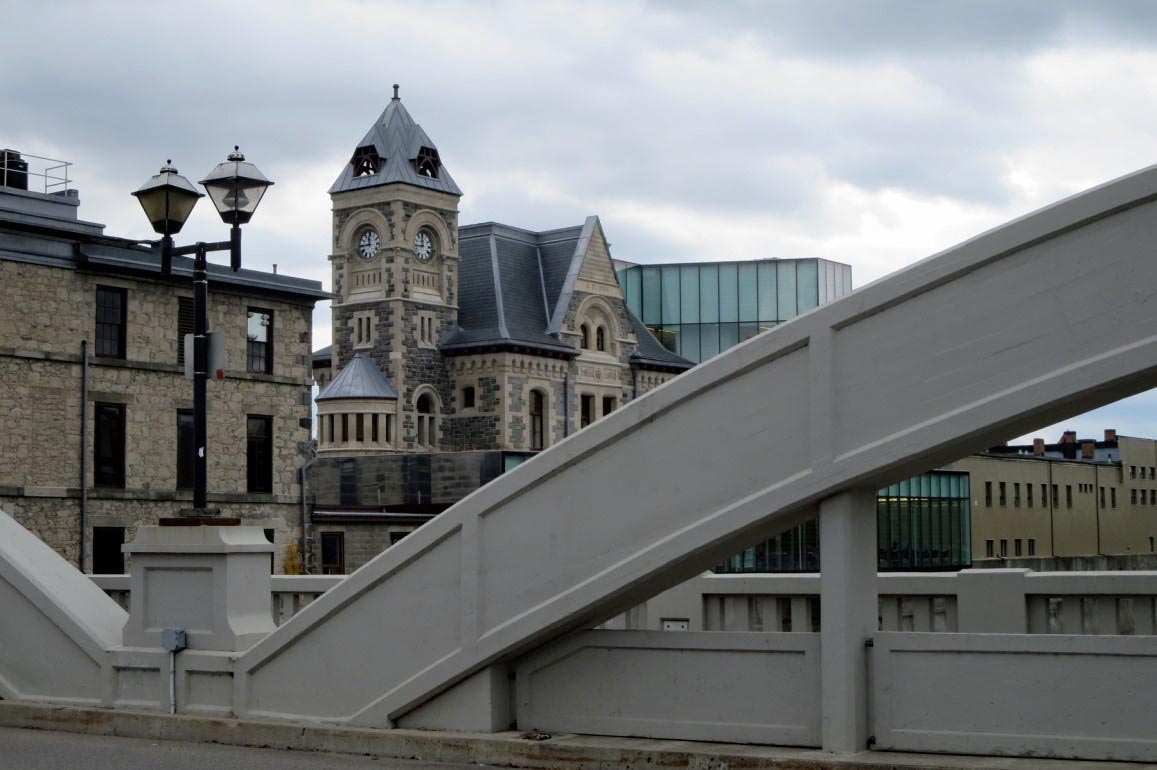
Old Post Office. Galt’s stately former post office building, constructed in 1885, is now part of IdeaExchange, Cambridge’s public library system. Framing the building in this photo are the arches of Main Street’s concrete bowstring-arch bridge (1931.)
Flood protection. In May 1974, the Grand River flooded Galt’s downtown area, causing approximately $5 million in damage. Since then, the river bed has been dug deeper, and raised berms erected on both sides of the river. A number of residential buildings were torn down to make room for the berms, creating some river-side green space.
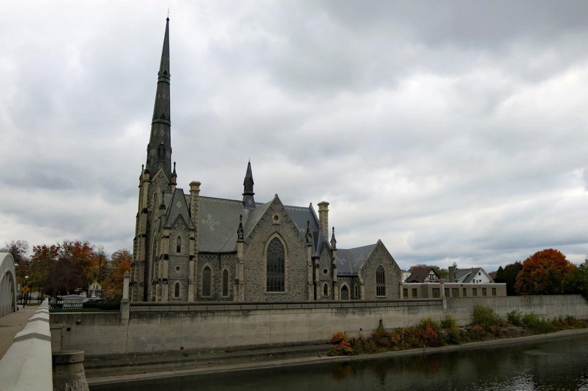
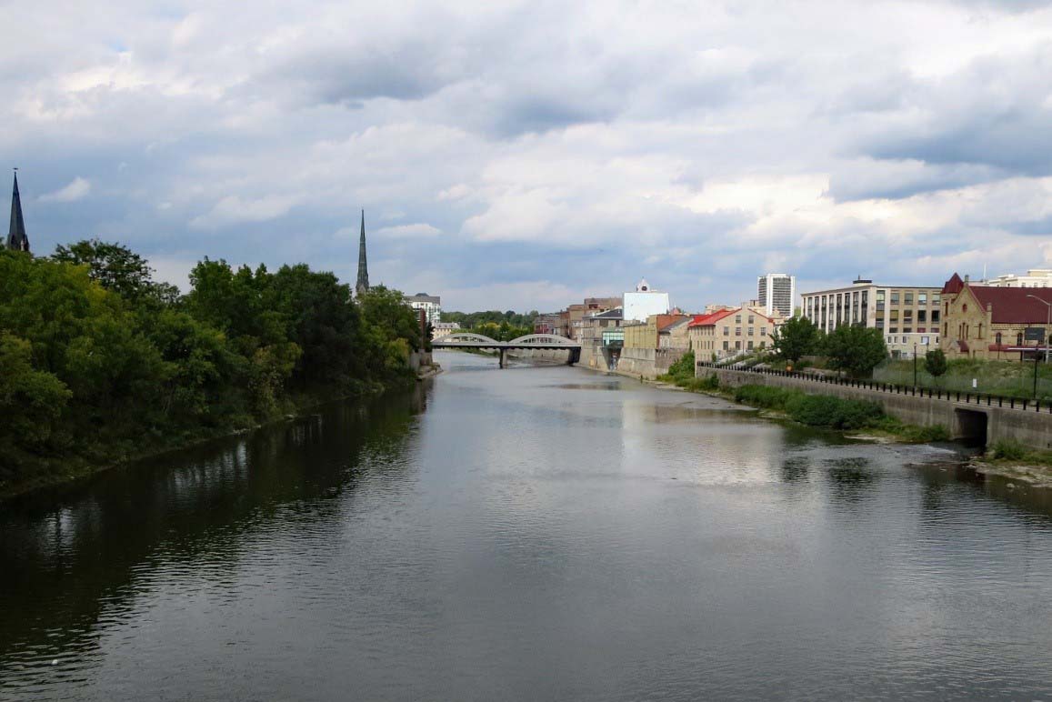
Dreaming spire. The 184-foot spire of Central Presbyterian Church towers above the west bank of the Grand River. The stone church, built in 1880, is one of two large churches near Queen’s Square. The other, Knox’s, is also Presbyterian.
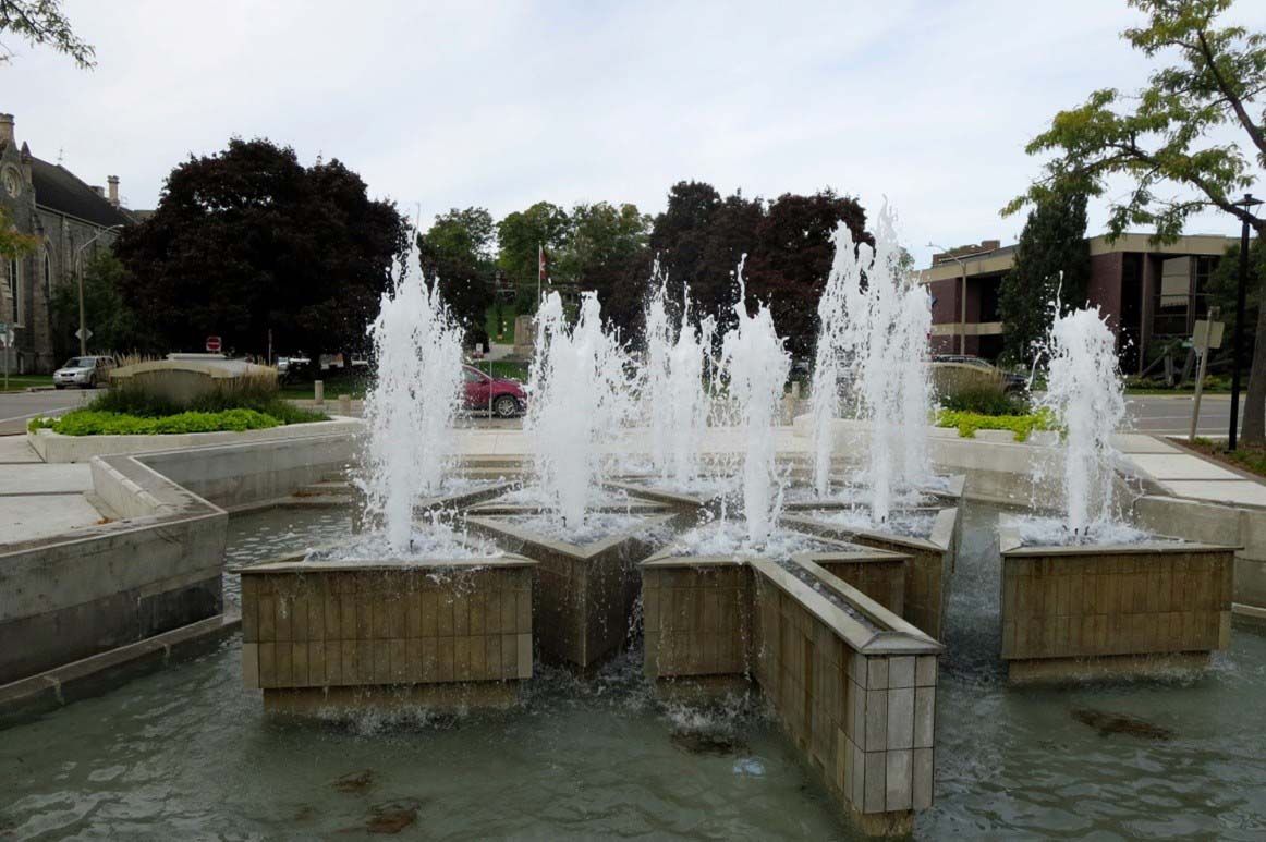
Queen’s Square. The fountain in Queen’s Square was built in 1967 to mark Canada’s centennial. Centennial Fountain, shaped like a stylized maple leaf, was refurbished in 2017, for Canada’s 150th birthday.
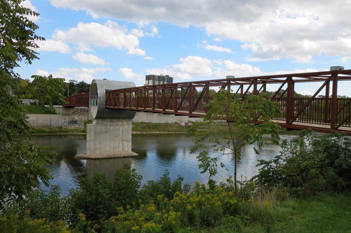
From trains to trails. The supporting structures of a former railway bridge were repurposed in 2018 for a pedestrian bridge over the Grand River. The bridge links sections of the 7.5-kilometre Grand Trunk Trail, part of Cambridge’s network of natural and urban trails for walking or biking.
Travel alert: Cambridge is about 100 kilometres west of Toronto, along Highway 401. The Region of Waterloo Airport is a few kilometres north of the edge of the Preston area of Cambridge (about 14 kilometres from Galt’s downtown core), and has flights to and from many major Canadian cities. Local public transportation is provided by Grand River Transit, which operates in Cambridge and the neighbouring cities of Kitchener and Waterloo.